Aleppo Archive in Exile

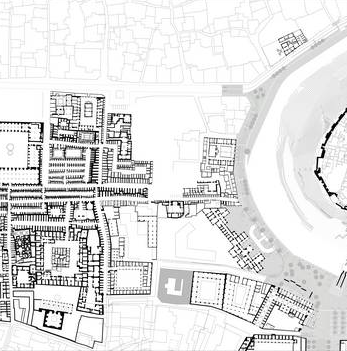
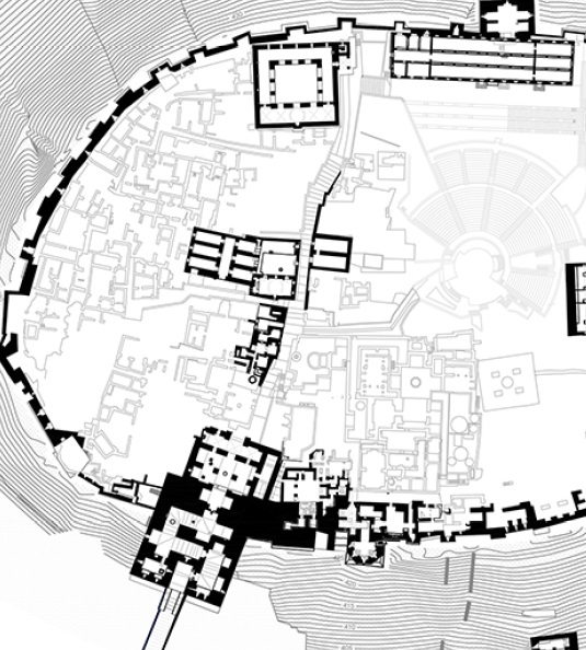
Urban morphological ground-plans of the development of old city Aleppo

The pictures became viral and spread around the world: Once one of the largest trade centres in the Middle East, now a city remained in ruins. Scientific researchers of BTU Cottbus – Senftenberg have worked out on foundational documentations for future planning toward reconstruction of the city, particularly including a detailed digital map of the old city of Aleppo.

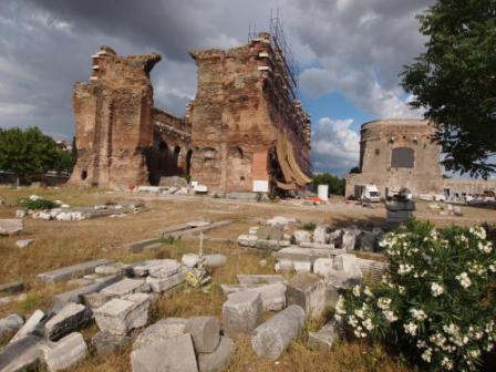
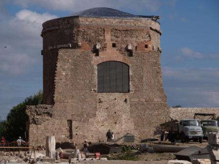
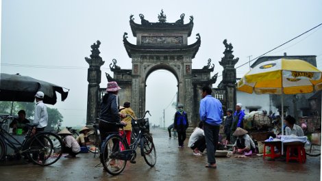
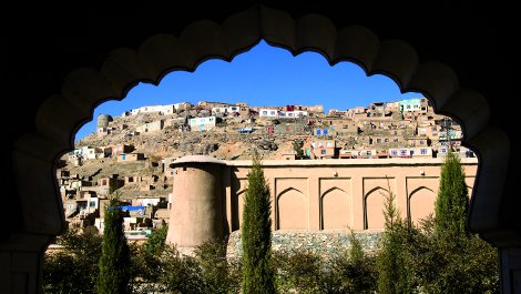
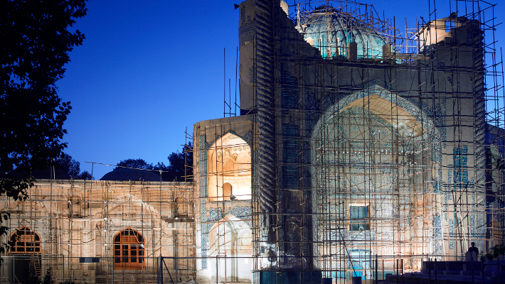
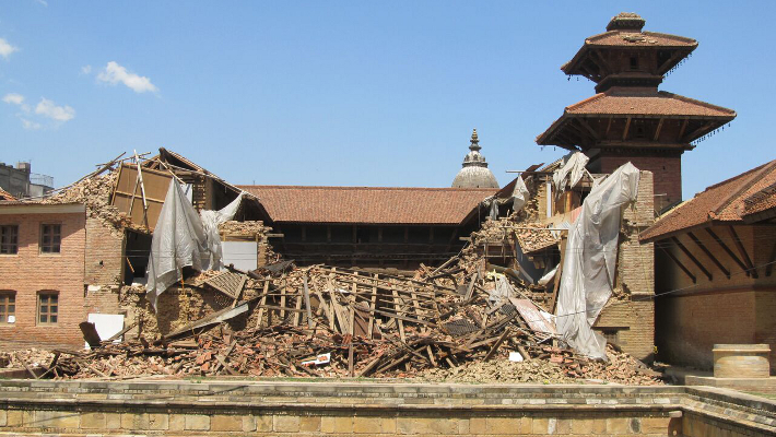
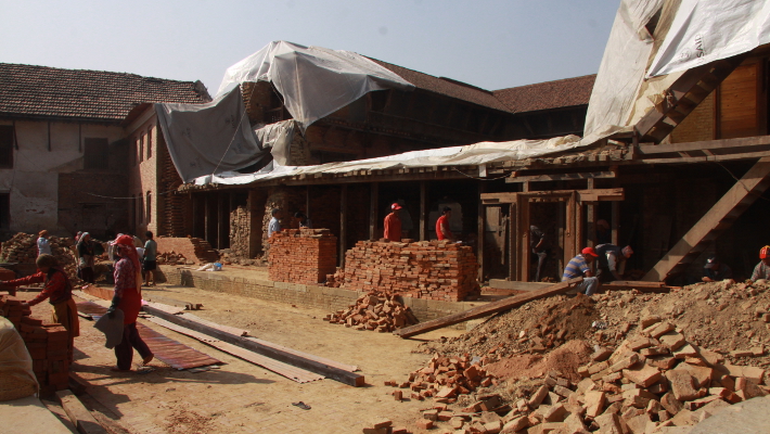
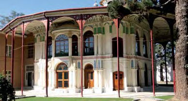
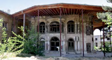
Aleppo, second largest city in Syria and one of the oldest continuously inhabited settlements in the World, has been suffering for six years under the civil war. Prior to the clashes 2,5 Million people lived in the city. Today more than half of the population have fled their homes. During the civil war large parts of the city, in particular the old city which was declared as a World Heritage Site by UNESCO since 1986, have been severely damaged.

Under the supervision of the project manager Christoph Wessling, researchers had to deal with a never-ending task. Around 20 Gigabyte data were systematically worked out and further included within the map of the old city on the printing scale of 1:1000 (working scale of 1:500), which illustrates the urban structure and built status by the year 2011.

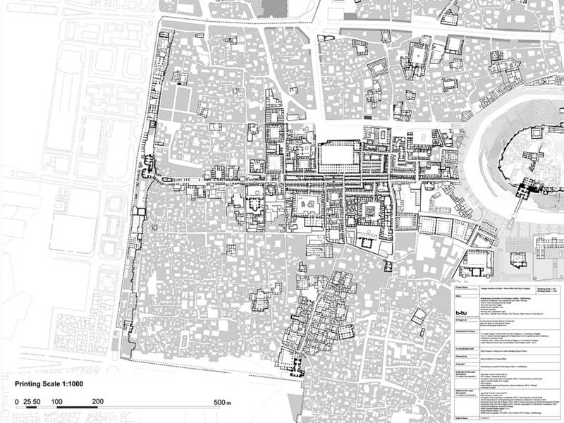
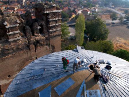
Until shortly before the outbreak of the civil war, the urban planners and architects of the university were involved in a cautious renovation and revitalization of the old city which was threatened by decay and depletion. In 2004, the German-Syrian project which was supported by the Deutsche Gesellschaft für Technische Zusammenarbeit (German Corporation for Technical Cooperation) with € 20 million of funds, was awarded the Harvard School of Design prize, in the category of urban design and planning. At present the collected data of that time have been instrumental in facilitating the reconstruction process. The map has been created based on the cadastral plans of Aleppo and includes 16000 parcels of the old city, around 400 ground-plans of significant buildings such as the Souq area, the Citadel, the buildings south of the Citadel and numerous buildings, among others in the quarters of Bandarat Al-Islam, in Al-Jidayda as well as in Al-Bayade and Jibqarman.

Numerous maps and planning documents with ground floor plans and the recently designed public spaces have been included in the map. Moreover, the most significant urban transformations of the 20th century could be further traced through overlaying the urban and parcel structures of the 1937 cadastral plans with that of the pre-war cadastral plans. As a result, the urban structure that is currently hidden under the building ruins became visible. Where today only rubble can be seen, the map shows the foundation walls, paths, alleyways and parcel structures underneath.

With downloads!

Source: https://www.b-tu.de/middle-east-cooperation/research/research-projects/aleppo-archive-in-exile


The Red Hall in Bergama.

The Red Hall in Bergama (Turkey)

Bergama is a small town in Turkey, 80 kilometres north of Izmir. Its archaeological fame derives above all from an altar, the remains of which are displayed in a Berlin museum that even bears the town’s ancient Greek name: Pergamon. Not quite so famous as the altar is the enormous temple dedicated to multiple deities and situated in the heart of Bergama; together with a forecourt it covers an area almost as large as that of Trajan’s Forum in Rome. The towering structure threw much else into the shade and inside it were sculptures on the same colossal scale. Figures eight metres high and wearing bulky headdresses held up the stoa roofs, creating the right atmosphere for worship of the gods and practice of the probably imperial cult – for the temple was Roman, dates from the 2nd century AD and the involvement of the Emperor Hadrian in its erection is very likely. The support figures were inspired by images of Egyptian deities and it is suspect that they found their way to Pergamon through the well-known trip of the emperor  to the Nile and his following travel through Asia Minor. The building project radically changed the urban landscape; even the river Selinus was channelled through two tunnels, and today the ancient ruin is still a dominant feature of modern Bergama, which accordingly can boast one of the most significant Roman monuments in all Asia Minor. The main temple building is known as the “Red Hall” after the red bricks from which it is made.

The round tower.
The round tower.

Unlike the ruins of the Hellenistic citadel, the Red Hall was absorbed into the modern town. It therefore never became covered by earth, but was reused for various purposes over a period of more than 1500 years. This repurposing necessarily left its mark. The southernmost of the two round towers, for instance, once accommodated an olive processing factory, among other things, and was particularly at risk. Rainwater entered the building through the original Roman dome, while archaeological finds weighing several tons were stored on a fragile, vault-borne floor which had already collapsed at several points. In 2006, the Istanbul Department of the German Archaeological Institute (DAI) launched a long-term project – directed by Felix Pirson and Martin Bachmann and supported by the Studiosus Foundation e.V. –  to restore the tower and to consolidate and re-cover the original Roman dome construction. In 2008, with funding from the Foreign Office’s cultural heritage preservation programme, a durable lead covering was laid on the dome to protect the ancient fabric for the coming decades.

Roofers at work.
Roofers at work.

Once this part of the project was finished, visitors could be admitted for the first time to the impressive interior of the rotunda. The opening ceremony took place in September 2009. In the same year another project began in one of the side courtyards of the Red Hall – likewise with the assistance of the Studiosus Foundation. Here, one of the support figures which formerly lined the courtyard in place of columns and fragments of which are now exhibited inside the rotunda was reconstructed in its original height and using some of the original pieces. The Egyptian deity Sekhmet was re-erected in Bergama on 26 September 2013.

The combination of research and preservation as practised by the DAI produces lasting and sustainable results and has created milestones in the preservation and presentation of archaeological monuments in Turkey. Modern urban and social contexts are playing an increasingly important role in this. The Red Hall was chosen as a core project because it fulfils a key function in the new tourism development plan for Pergamon.

The support figures were inspired by images of Egyptian deities.

In future, the old town of Bergama with its many monuments of Ottoman and multiethnically influenced architecture will be integrated to a larger extent in the sightseeing programme. Visitors will thus be able to experience 4000 years of settlement and urban history in the eastern Aegean in and around a modern Turkish town. The new presentation plan for the town of Bergama spans the epochs and encompasses the surrounding area. That was central to Bergama’s addition to the list of UNESCO World Heritage Sites in 2014. The past, present and future of the town are consequently woven together in this DAI project in a way that benefits not only archaeological research but also the town itself.

Project: Prof. Dr. Felix Pirson, director of the Istanbul Department of the DAI and director of the Pergamon Excavation.

Promoted by: Foreign Office’s cultural heritage preservation programme, Studiosus Foundation e.V., Ernst Reuter Initiative, Culture Foundation of German-Turkish Business

Cooperation partners: German Archaeological Institute (direction and implementation), Institute of Building History, Building Archaeology and Conservation at the TU München (structural documentation), Ulrich Mania – Kiel University (conceptual planning), Josef Steiner – Construction Engineering Group, Karlsruhe (support structure planning), Adnan Elidenk, Bergama (steel construction), Christof Kronewirth, Berlin (stonemasonry), Semih Uçar, Istanbul (lead roofing)

Source: Archaeology Worldwide, the magazine of the German Archaeological Institute

Historic village centre of Tran Dang.

Historic village centre restored to its former glory (Viet Nam)

The historic village centre of Tran Dang in north-east Viet Nam is testament to a rich cultural heritage. Here, where for centuries people have met, traders bartered and believers worshipped protective spirits, restoration workers are endeavouring to preserve historic evidence.

The ancient village centre of Tran Dang – the village hall, the socalled Dinh, being the oldest building – dates back to the 13th century. It stands on a peninsula shaped like a tortoise – one of the four animals held as sacred by the Vietnamese. The joists and beams of the building are decorated with valuable – because of the degree of craftsmanship – woodcarvings. Some are in colour, some purely ornamental, while others depict scenes from folklore and mythology. On the roof ridge there are figures of sacred animals made of rare black clay.

The Dinh was later extended to include an altar room to honour the village’s protective deity. The bell tower, village fountain, the bridge to the Dinh and the main gate to the square date back to the later Nguyen Dynasty (1802–1945). It was during this period that the most recent innovations of historical and artistic value took place. During the Vietnam War, the tower bells warned the surrounding villagers of American bombing raids and the village hall was used to store rice and other food. After the war, makeshift repairs restored the damaged building for use as the focus of the village community once more.

Over the centuries the inhabitants of Tran Dang have done their best to look after and maintain the building. Over time, however, infestations, water damage and the effects of age have taken their toll on the building. The task of maintaining it was too great for the local population, who lacked both funding and the necessary expertise.

Now, with funding from the Federal Foreign Office’s Cultural Preservation Programme, the entire construction of the Dinh – built of ironwood – has been restored in line with its value as a historic monument. The roofs of the main house and altar room extension and other historic features have also been restored. The buildings adjacent to the village hall and the village fountain, also situated in the centre, will be restored next. The village inhabitants are closely involved in the work.

That the historic centre of Tran Dang can already bask in its newfound glory is the impressive result of the restoration work so far.

Project: Andrea Teufel, Project Director, German Conservation Restoration and Education Projects (GCREP)

Promoted byCultural Preservation Programme of The Federal Foreign Office

Source: Worlds of Culture, Ed. Federal Foreign Office

Bagh-e Babur.

Bagh-e Babur – Gardens with a splendid past (Afghanistan)

Babur Gardens, known as Bagh-e Babur, in the Afghan capital Kabul are an oasis of peace in a wartorn land. With over a million visitors since they reopened in 2008, the gardens are the city’s most popular leisure attraction and at the same time an important witness of Afghan history.

South-west of Kabul Old Town, at the foot of Kuh-e Sher Darwaza hill, lies Bagh-e Babur, one of the oldest surviving gardens from the Mughal period. Bagh-e Babur, laid out after the conquest of Kabul (1504), was one of many gardens established by Zahir ad-Din Muhammad Babur (1483–1530), the founder of the Mughal dynasty. The ruler’s passion for gardens had a long tradition: for thousands of years gardens had been an integral part of home and palace culture. In the Islamic world, garden planning and design incorporates both religious concepts and aesthetic principles. Intricate geometric forms on either side of a central axis reflect order in diversity, transposed in nature with marble water-channels, fountains and cascades. The garden is a metaphor for divine order and, as a paradise on earth, a place of refuge for the faithful.

The garden’s importance – and its survival to the present day – is due to Babur’s wish to be buried there, in his homeland, far from the hot Indian plains. As his last resting-place, Bagh-e Babur became a place of pilgrimage for his successors. Their memoirs contain detailed descriptions of the work they financed to embellish the gravesite. After the collapse of the Mughal empire, from about 1750, the garden fell into neglect. Lithographs, early photos and travel writings from the 19th century show it to be unkempt. It was not tended again until Amir Abdur Rahman Khan, the first ruler of a united Afghanistan (r. 1880–1901) and a keen builder, took the garden in hand and radically altered it in keeping with the style of the day. The last major changes date from the reign of Nadir Shah (1929–1933), who put a European stamp on the gardens. It was this garden which withstood the time of war and political confusion, with its sparse vegetation and pockmarked by the detritus of war.

Initial plans to redesign Bagh-e Babur paying heed to its historical roots were made back in the 1970s, but the political situation was such that they could not be implemented. It was not until 2002 that a new chapter in the long life of the garden began. Following the discovery of structures from the Mughal era during the investigations carried out by the German Archaeological Institute (2002–2005) the interdisciplinary rehabilitation project of the Aga Khan Trust for Culture modelled the reconstruction of the garden on this research.

Responsibility for the garden passed into Afghan hands in 2008, and it has since been managed by an independent trust. In view of its historical importance, Bagh-e Babur became part of UNESCO’s Tentative List for inclusion in the World Heritage List in 2009.

Project: Ute Franke, archaeology Projects Director, Museum of Islamic Art, Berlin; Jolyon leslie, Programme Manager, Aga Khan Trust for Culture, Afghanistan

Promoted byCultural Preservation Programme of The Federal Foreign Office

Source: Worlds of Culture, Ed. Federal Foreign Office

Restoration of the badly damaged roof of the Church of the Nativity.

Restoration of the Church of the Nativitiy in Bethlehem (Palestinian Territories)

The Church of the Nativity in Bethlehem is a unique architectural ensemble comprising elements from 1700 years of varying cultural influences. The Church, which was declared a World Heritage site in 2002, is probably the oldest sacred building in continuous use in the Holy Land.

“Ubi natus est Dominus Iesus Christus, ibi basilica facta est iusso Constantini.” B. Bagatti, Gli Antichi Edifi ci Sacri di Betlemme, Franciscan Printing Jerusalem (1983)

Built in 339 AD under the auspices of Helena, the mother of Emperor Constantine, the original structure of the Church of the Nativity was largely destroyed, then rebuilt by Justinian in the mid-6th century and redecorated by the Crusaders in the 12th century. Today the Church is overseen jointly by the Greek Orthodox, Catholic and Armenian Churches, which means that the daily services and numerous religious festivals of all three have to be taken into account during the restoration work.

Restoration began in 2013. Supported by the international community and the Palestinian Authority, the Italian restoration experts of Piacenti s. p. a. first tackled necessary work on the roof and windows, then on the external walls, nave, plaster and mosaics.

From a platform at the level of the joists, a temporary roof was installed to allow the restoration of the ancient roof system. Decayed sections of the joists were removed and replaced with ancient wood brought from Italy. The prime aim of these restorations was to retain as many of the original materials and elements as possible.

The external walls and internal plasterwork had been badly affected by rain, humidity and some microbiological damage. Restorers specialising in the conservation of stone and plaster therefore first cleaned all the surfaces and removed extraneous materials, filling in cracks with a suitable mortar and consolidating the most badly damaged areas. At the same time, work on the nave began.

View from the nave to the eastern door.

A considerable amount of German support has been directed towards the restoration of the Church’s eastern door to the nave – a large ancient wooden structure with ornate woodcarvings which will soon again open to one of the most fascinating churches in history.

Project: Christian Schaal, Giammarco Piacenti, German Representative Office Ramallah in cooperation with Piacenti s. p. a.

Promoted by: Cultural Preservation Programme of The Federal Foreign Office

Source: Worlds of Culture, Ed. Federal Foreign Office

The Chinese port city of Qingdao.

Traces of Germany in the Middle Kingdom (China)

From 1898 until 1914 the Chinese port city of Qingdao was a German concession. Even today the face of the city is dominated by old German architecture: Christ Church in particular bears witness to a bygone age.

Christ Church, originally called “New Church”, was built by the Berlin Protestant Church Board between 1908 and 1910 and consecrated on 23 October 1910. Following the proclamation of the People’s Republic of China by Mao Tse-Tung, the then last service in Christ Church was held on 27 November 1949, the first Sunday of Advent.

In the wake of the reform and opening-up of China, the exercise of religion under state control is again possible. Sunday services have been celebrated in Christ Church again since 1980. Today the church has around 1200 members and is used for baptisms, confirmations and weddings. It has a lively musical life ranging from the church choir to rap.

Christ Church after a well-attended sunday service.

The Free State of Bavaria, as part of its twinning link with Shandong Province, has done much to preserve the German cultural heritage in Qingdao. Now the Foundation for the Preservation of German-Style Buildings in China, with a grant from the Cultural Preservation Programme of the Federal Foreign Office, has worked with German experts to reconstruct the copper covering on the top of the spire. At the same time, the roof was restored with a weathercock to replace the one which fell in a storm in 1942. The next projects planned are the restoration of the pipe organ and the ornate leaded windows, which were destroyed during the Cultural Revolution.

The restoration of Christ Church’s capped roof is no mere construction project; it is a highly symbolic project, a special way to approach Sino-German history.

Clock of the Christ Church.

Qingdao, whose economy and population are growing rapidly, is increasingly looking to its German colonial heritage, not so much out of nostalgia but rather in the realization that preserving and restoring its historic architecture will give it a competitive advantage over other cities which are becoming ever more faceless and similar as a result of modernization.

Although other cities, e.g. Weifang, Wohan and Tianjin, have notable German-style buildings too, only Qingdao has an Old Town laid out entirely in the European style. An application has been submitted for its inclusion in the UNESCO World Heritage List.

Project: Harm Oltmann, foundation for the Preservation of german-style Buildings in China; Martin Fleischer, German Embassy in Beijing

Promoted by: Cultural Preservation Programme of The Federal Foreign Office

Source: Worlds of Culture, Ed. Federal Foreign Office

Exterior of the Khvajeh Abu Nasr Parsa shrine.

Restoration of the old town and regional development in Balkh (Afghanistan)

The town of Balkh, which was known as Bactra in ancient times, dates back to 500 B.C. and is situated some 20 kilometres north-west of Mazar‑e‑Sharif in northern Afghanistan, on what was once the Silk Road. It is regarded as the cradle of Iranian civilisation and has been an important pilgrimage site from time immemorial. 

Over the course of its history, Balkh has been a spiritual centre of Zoroastrianism, Buddhism and Islam respectively. It served as one of Alexander the Great’s northernmost bases from 329 to 327 B.C. It was completely destroyed by the Mongols under Genghis Khan in 1220 and only rebuilt in the fifteenth century under Timurid rule. However, the town’s significance continued to decline, not least as a result of the provincial government’s move to Mazar‑e‑Sharif in 1866.

Extensive restoration

In addition to supporting restoration and stabilisation work on important buildings such as the Khvajeh Abu Nasr Parsa shrine, the Dehdadi Mosque, the Sudhan Qoli Madrassa Gate, Abu Zaidan Mosque and minaret, and Mir Rusedar and Khvajeh Nizamuddin shrines, the Cultural Preservation Programme of the Federal Foreign Office is funding the restoration of the buildings’ gardens and public spaces. The aim of this major project is to improve local residents’ living conditions and infrastructure in the long term by constructing infrastructure such as roads, sewage systems and waste disposal systems. 

Interior of the Khvajeh Abu Nasr Parsa shrine.
© AKTC


Close involvement of the population

A further part of the project involves training programmes in traditional crafts such as carpentry, bricklaying and the manufacture of glazed tiles. Involving the local population and administration closely at all levels creates cultural identification with the local historical heritage and increases the sense of responsibility for this identity. The project is a good example of how cultural preservation can be achieved in harmony with economic development, modern urban planning and the needs of the local population.

At the suggestion of the Afghan Government, Balkh old town was added to UNESCO’s Tentative List of World Cultural Heritage in 2004.

Project promoted by / SourceCultural Preservation Programme of The Federal Foreign Office

The Beth El synagogue in São Paulo

Restoration of a Synagogue (São Paulo, Brazil)

Funding from the Cultural Preservation Programme of the Federal Foreign Office made it possible to restore the Beth‑El synagogue, built in 1929 and inaugurated in 1932 in the centre of São Paulo, to its former glory.

The biggest city in the southern hemisphere with the longest traffic jams, the greatest number of helicopters, the best restaurants, the biggest German centre of industry in the world – São Paulo is a megalopolis, a city of superlatives. And right at the heart of its once run‑down centre there is yet another superlative, namely the most important Jewish sacred building in Brazil, the former Beth‑El synagogue.

Revival of the centre of São Paulo

Beth‑El was restored with funds from the Cultural Preservation Programme of the Federal Foreign Office and is now an integral part of the first Jewish museum in Brazil currently under construction. The museum complex will, moreover, be part of the work already begun to restore and revive the city centre. 

Amongst other things, the original plaque of architect Samuel Roder has been uncovered, along with a stone model of the building and above all, the original materials and colours, all so that the Synagogue can shine not only with a renewed freshness, but also in its original glory. Along with the façade, the magnificent dome in Byzantine style and the stained glass windows, the wooden altar with its Torah shrine and the original benches dating back to 1932 were restored.

A German-Brazilian symbiosis

“The German restoration of the synagogue is a quantum leap,” commented the museum’s Director, Roberta Sundfeld, and “it has already attracted sponsors to the museum.” In this case, the Cultural Preservation Programme is not just living up to its name, it has provided the impetus for new projects and is thus a beautiful German-Brazilian symbiosis, symbolising the vibrant history of the centre of São Paulo.

Project: Eva Dombo, German Consulate-General in São Paulo

Promoted byCultural Preservation Programme of The Federal Foreign Office

SourceWorlds of Culture, Ed. Federal Foreign Office


The palace’s interior courtyard with the Tusa Hiti fountain.

Restoration of Patan Royal Palace (Patan, Nepal)

The Kathmandu Valley in Nepal boasts no fewer than seven World Heritage sites. One of them is Patan Royal Palace along with the temples in the palace complex. Following the two earthquakes in April and May 2015, the Federal Foreign Office, which has been committed to the preservation of this cultural heritage site for years, joined with the Gerda Henkel Foundation to launch a joint initiative to rebuild damaged cultural property in Nepal.

Since 2008, the Federal Foreign Office has provided a total of 250,000 euros for the preservation of the palace and the temples in the complex. For example, in various stages, the fountain in the south courtyard, Sundari Chowk, and the Bhandarkal water tank were restored, followed by the building’s south wing and the rear section of Sundari Chowk. When Nepal was hit by a severe earthquake in April 2015, the restored wings of the square courtyard stayed standing, but virtually the whole east wing caved in.  

Only the ground-floor arcade remained. But work to rebuild the east wing started quickly, in the autumn of 2015, again with support from the Federal Foreign Office.

Structural elements which were salvaged are being used in the restoration

All the beautifully carved wooden elements rescued from the ruins, as well as the tiles which were recovered, are being used to help rebuild the courtyard’s façade. This is possible thanks to the traditional construction techniques using clay mortar, especially as the masons and carpenters are the descendants of those who created this architecture back in the 17th and 18th centuries. 

The upper storey of the main courtyard building has been home to the “Architecture Galleries” museum of architecture since 2013. This is open to the public as part of Patan Museum, which was established in 1997. When work on the east wing is finished, Sundari Chowk will complete the museum in January 2017. The restoration, reconstruction and conversion work gives an immediate insight into a multifaceted palace complex which contributes hugely to the identity of the Kathmandu-Patan metropolis and is thus a symbol of the area’s rich architectural heritage. 

Responsibility for implementing the work lies with the Kathmandu Valley Preservation Trust, which has saved and restored numerous buildings in Kathmandu and Patan since 1992. Between 2016 and 2018, with help from the Gerda Henkel Foundation, the Krishna temple will be repaired and the collapsed Hari Shankar temple rebuilt. 

Project promoted by / SourceCultural Preservation Programme of The Federal Foreign Office


Master Program “Architectural Conservation” at GJU Amman

The Master Program “Architectural Conservation” is a cooperation program organized by the Department of Historic Building Conservation and Research from the RWTH Aachen University and the Post-graduation Master program
Cultural Heritage at the TU-Berlin in cooperation with the German Jordanian University.

The aim of this cooperation is to revive the Master Program “Architectural Conservation”, originally programmed by GJU by sponsoring 30 Jordanian and refugee students with a full scholarship. The German side is supporting the
program with Visiting Professors experts in the field, while the main bulk of the teaching is provided by the GJU teaching staff and professors.

The Program is sponsored by the German Federal Foreign Office as part of the project “Die Stunde Null – Eine Zukunft für die Zeit nach der Krise”.(Literally meaning Zero hour: a future after the crisis).

Moreover, the project is an initiative by the “Archaeological Heritage Network” and under the directorship of the DAI “German ArchaeologicalInstitute” in cooperation with the DAAD ” German Academic Exchange Service”.

We are looking forward for a productive and successful cooperation, especially for all the students.

Source: RWTH Aachen University

Künftig soll es möglich sein, über einen Computer, das Tablet oder Handy auf die digitale Karte der Altstadt zu tippen.

The Memory Bank – A digital Plan for Aleppo

A digital map of Aleppo’s ancient city centre is going to help to rebuild what was once one of the biggest trading hubs in the Middle East.

The pictures of a ruined city that was once one of the Middle East’s major trading hubs have gone around the world. Researchers from BTU Cottbus–Senftenberg are working on concepts for the rebuilding of this city. The potential basis for the future rebuilding plans is a detailed digital map of Aleppo’s ancient city centre.

Civil war has raged in Aleppo, Syria’s second-largest city and one of the oldest permanently occupied human settlements in the world, for five years. Before the conflict, this was a city of 2.5 million people. Today, more than half of its population has fled. In the course of the civil war, much of the city, especially its ancient city centre, a UNESCO World Heritage Site since 1986, has been heavily damaged.

The researchers headed by project manager Christoph Wessling are facing a Sisyphean task. Around 20 gigabytes of data have to be systemised. Until shortly before the civil war broke out, the university’s urban planners and architects were involved in the socially sensitive renovation and revival of the ancient city centre, which was threatened by decay and poverty. In 2004, the German-Syrian project, which was funded by the Deutsche Gesellschaft für Technische Zusammenarbeit with €20 million, won a Harvard University Graduate School of Design urban planning award. The data collected at the time now comes in useful as it will make it possible to reconstruct the city. The researchers are combining roads, pavements, public spaces with fountains, statues or gardens and the floor plans of former buildings from 2011 digitally, which will make a reconstruction possible.

The aim is that in future, a tap on the digital map of the ancient city centre using a tablet computer or a mobile phone will reveal all of the building plans, photographs and descriptions for a particular location. Buildings and other city structures that are currently buried underneath the ruins will become visible. Where piles of rubble are all that is left today, the map shows the foundations, roads, lanes and plot structures that still exist underneath.

“These structures are the basis for the UNESCO World Heritage Site classification. With this project, we want to raise the general awareness of the rebuilding work that will be needed once the conflict is over, and prevent undesirable urban development that may ignore these important basic structures,” says Prof. Heinz Nagler, the head of the Urban Planning and Design department. “Our aim is to create a qualified planning basis for the rebuilding of the city. Future individual construction projects can be integrated into this overall picture to then be evaluated accordingly. We are thereby making a major contribution towards preventing the potentially insensitive large-scale renovation of Aleppo’s ancient city centre after the civil war, and are making a critical reconstruction process possible that also takes the interests of the city’s inhabitants into account”, summarises Prof. Dr. Klaus Rheidt, the head of the Building History department.

The researchers hope that this map will be completed by the end of the year, and can then be made available to the Syrian Heritage Archive at the German Archaeological Institute (DAI). However, the map could also be used by Aleppo’s city council, the city’s future urban development planners, potential investors, decision-makers and urban designers, researchers, journalists, writers and the interested public as a basis for the classification and evaluation of future projects.

The project is part of a pilot project entitled “Stunde Null: A Future for the Time after the Crisis”, which addresses the issue of the rebuilding of Syria after the war. It will be the first project to be carried out within the scope of the Archaeological Heritage Network, which focuses on the conservation of cultural heritage. The network and the project receive funding from the German Federal Foreign Office. The BTU subproject will receive funding amounting to €75,000 until December 2016. An extension is planned.  

Project and Source: BTU Cottbus-Senftenberg